

Map of bike paths / walking paths in Walla Walla, WA
Recreational trails for walking, running and cycling in Walla Walla, Washington
Walla Walla, Washington
![]() Click on the key symbol in the main map to zoom into specific trails.
Click on the key symbol in the main map to zoom into specific trails.
BIKE PATHS / WALKING PATHS
Myra Road Trail
Highway 12 Trail
Kingfisher Trail
Mill Creek Trail
Murr Field Trail
Pioneer Park Trail
Whitetail Trail
Yellowhawk Creek Trail
RELATED LINKS
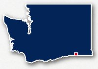
Walla Walla is located in the southeast corner of the State of Washington. It is situated 30 miles west of the Columbia River and 5 miles north of the Oregon border. The city has a mild and sunny climate and offers many opportunities for outdoor recreation.
There are several multi-use pathways that follow alongside major roadways. There are alos a number of otehr recreational trails.
Mill Creek Trail
The Mill Creek Trail is a 2.5-mile long paved pathway that spans from Eastgate Lions Park to Rooks Park on the east side of Walla Walla. The trail goes past Walla Walla Community College and connects to the Kingfisher Trail.
The Mill Creek Trail also goes past the Mill Creek Sportsplex on the south side of the creek.
Kingfisher Trail & Whitetail Trail
The trails connect to the Mill Creek Trail near Walla Walla Community College and head south to Bennington Lake.
Highway 12 Multi-Use Path
The Highway 12 Multi-Use Path follows alongside the roadway for almost 3 miles from Bowman Street to Wellington Avenue.
Resources
Following are links to official off-site resources to find out more details about the recreation paths for cycling and walking in Walla Walla, Washington.

Tweet