

![]()
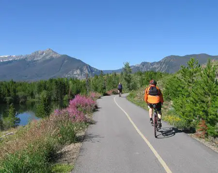
The purpose of WalkRideUSA.com is to present Google based maps for recreational trails located throughout the United States. Along with the maps are brief descriptions of the major trails presented on the map. Our maps include over 300 cities in the continental United States and hundreds of individual trails.
Our focus is on public paths that have been created for non-motorized use by government or other agencies. Some trails may be within state parks or other areas that require a fee to enter. Not all paths shown are suitable for walking and bike riding and running. Use discretion and follow local regulations. Some paths are paved and others are not. Click on the Satellite view and zoom in to get more detail about the trail.
We hope to encourage the use of these trails. They provide a healthy and inexpensive way to see many areas that you would never see from a car window. As people see how valuable these trail systems are, the government agencies will be prompted to build more trails, improve the ones that exist and set up planning for future trails with new development.
What are these trails used for?
The recreational trails presented on this site were built for one or more of the following activities:
- bike riding / cycling
- walking
- running
- access to natural areas
- bird-watching
- access to fishing
- natural buffer zones
- commuting to work or school
- school trips
- horseback riding
- getting to school safely
- access to athletic fields and parks
Not all trails allow all of these activities. Be aware of any local rules and regulations that may limit activities along the trails and be courteous to other trail users.
Why create this site?
This site is being created to present a more standardized way to see the trails systems that may spread across several separate communities or counties. It is a way to get the overall feel for where the trail is located as well as being able to easily zoom up to see local details. You can see where trail systems meet, if they go past a specific park or school, where you can park to catch the trail, and many other details. It may well be that you see trails that you were not even aware of in your own community.
The current information about these trails on the internet is fragmented. Each community has it's own page for parks and maybe for the trails. These pages are not presented in a standardized format and the links may be .pdfs which are very large files and difficult to download or to view local details. Walk Ride USA provides links to these pages if you are looking for more in-depth information.
What is different about WalkRideUSA from other sites displaying trails?
WalkRideUSA shows multiple connecting trails in each area for our city maps. This gives you a chance to see connecting trails and other details.
WalkRideUSA has the trails in various colors. This allows you to single out a specific trail in areas where several trails converge.
WalkRideUSA is free and does not require a subscription or to sign into Facebook or other social media.
Many of the maps for individual trails allow you to toggle the screen to show the single trail or nearby trails.
WalkRideUSA shows public parking areas, but does not clog up the map with unnecessary icons and information.
WalkRideUSA uses the familiar Google Map colors and scheme that most of us are familiar with so that streets and other features are easy to locate.
Trail Conditions or Construction
Since we are covering a vast area and hundreds of trails, we don't present any information about the trail's condition, construction or other activities. We do however try to provide links to local agencies that may possibly have this information or contact information to find out specific details.
Research
Before adding the trails to the Google Maps, we research the trails. We look for any maps or other information on the websites for the various local communities, cities, counties and states. If there are other official agencies involved with the trail system, we research this as well.
If you would like to see a trail in your community added to our site or if you see an error in our maps, please contact us at This email address is being protected from spambots. You need JavaScript enabled to view it.
The Trails on the Maps
The actual colored lines that are placed on the Google Maps that represent the route for the trails are digitized in Satellite mode so we can see the physical location of the trail. Trails within heavily forested areas are difficult to see in the satellite imagery and their location is approximate.
How to measure distances
Each of our maps has the option to use the distance measuring tool. You need to select the tool to enable it. Once enabled, each click on the map will add to the total distance. If you click on the small triangles, a popup info box will display the distance to that point from the first point on your line.
For more information on our maps, visit our page: The Maps on Walk Ride U.S.A.
Accuracy Disclaimer
We do our best to present accurate information. However, we are limited to the date for which the Google Satellite view was created. If the satellite view is two years old, we can only digitize the trail at its location at that time of the photographic image was taken. Sometimes the trail location has changed or improvements have been made, such as an underpass.
We take no responsibility for people getting lost or trails not being where we have shown them. By using this site and using these maps you must realize that this is simply a guide for the location of the trail. We cannot guarantee the location or the condition of the trail.
Advertisement
We include some advertisement on this website. This is to help cover the time involved in creating the site and the hosting expenses. We do our best to make the advertisement as inobtrusive as possible. We use Google AdSense advertising and the ads are provided by them. We do not control what advertisers are presented, other than to screen out specific controversial topics.
Please see out Privacy Policy page if you have any concerns about the advertisements presented.
Contact Us
If you feel that any information presented on this site is in error or should be clarified, or if you have a specific question that we can answer, we encourage you to contact us.
This email address is being protected from spambots. You need JavaScript enabled to view it.

Tweet