

Map of bike paths / walking paths in the Bellingham area
Recreation trails for walking, running and cycling in Bellingham, Ferndale and Whatcom County, Washington
Bellingham, Washington
![]() Click on the key symbol in the main map to zoom into specific trails.
Click on the key symbol in the main map to zoom into specific trails.
BIKE PATHS / WALKING PATHS
Bay to Baker Trail
Cordata Park Trail
Cornwall Park Trail
Downtown Bellingham Trail
Interurban Trail
Lake Padden Park Trail
Lower Padden Trail
Maritime Heritage Park Trail
Nooksack Loop Trail
Northridge Park Trail
Railroad Trail
Red River Pedestrian Path
Sehome Hill Park Trail
South Bay Trail
Squalicum Creek Park
Tenant Lake to Marine Drive Trail
Whatcom Creek Trail
Whatcom Falls Trail
RELATED LINKS
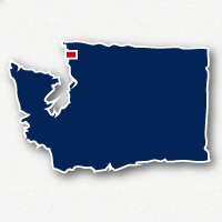
Bellingham and Ferndale are located in the northwest corner of the State of Washington. Bellingham is 22 miles south, and Ferndale is 13 miles south of the border with Canada.
This is an area of lush evergreen forests and beautiful views of Mt. Baker, Bellingham Bay and Lake Whatcom. The recreational trails in this area for walking and bike riding will take you along the waterfront of Bellingham, through the deep woods, strolling through neighborhood parks, along streams with lovely waterfalls or along lakes with gorgeous views of the North Cascades.
Parts of Bellingham have some hills, so you may be finding steep sections and the occasional set of stairs along the way as you travel the trails in town.
Bay to Baker Trail
The Bay to Baker Trail is a 1.5 mile long paved trail that goes from Squalicum Beach, through Little Squalicum Park, then wraps around the north border of Squalicum Creek Park. From there it heads north for another quarter mile to stop at Squalicum Way and Northwest Avenue. Squalicum Park is located at Squalicum Way and West Street on the north side of Ferndale, Washington.
Railroad Trail
The Railroad Trail is a 3.5-mile long improved gravel trail that loops around the east side of Ferndale through residential neighborhoods. The trail extends from just west of Interstate 5 to Bloedal Donovan Park near the north end of Lake Whatcom.
On the west end, the Railroad Trail starts at King Street, just north of E. North Street. It has a pedestrian bridge going over Interstate 5. The route of the trail takes you through a few forested stretches and past homes. When you get to the east side of Woburn Street the trail takes you right past Roosevelt Elementary School. Just past the school, the trail takes a big loop to the north. Near the north end of the loop, you can catch Klipsun Trail going into the neighborhoods to the east. Continuing on Railroad Trail, you take a big loop to the south to meet up with the trails in Whatcom Falls Park or head over to Bloedel Donovan Park.
After Whatcom Falls Park, the Railroad Trail heads north to end at Alabama Street and Electric Avenue.
Interurban Trail
The Interurban Trail is over 5 miles of unpaved pathway that travels all the way from Downtown Bellingham to Larabee State Park. The trail travels through the woods along Highway 11 for much of the way.
Whatcom Falls Park and Whatcom Falls Creek
Whatcom Falls Park is something you shouldn't miss if you are visiting this area. The park has a number of gravel pathways that wander through the woods. It is a hilly park with some steeper sections and stairs along the trail. Whatcom Creek wanders along a canyon with several picturesque bridges that you can cross and watch the rushing water. It is also a good place for observing wildlife.
South Bay Trail and Boulevard Park
The South Bay Trail is a 2.5-mile long paved trail that goes from Downtown Bellingham south along the shores of Bellingham Bay. This is a lovely walk with views back to the harbor and marinas and out to the San Juan Islands, a favorite place for watching the sunset over the water.
The north end of the trail starts at E. Laurel Street near N. State Street. From here is heads over to the water to follow through the trees along Boulevard. At Boulevard Park there are playgrounds, parking and a coffee shop. Just south of the park is the bridge and pier to walk out over the water. The south end of the trail is at Mill Avenue and 11th Street.
Tenant Lake to Marine Drive Trail & Nooksack Loop Trail
These two trails form a 5-mile long pathway in the Ferndale area. The Tenant Lake to Marine Drive Trail starts at the south end of Nielsen Road and follows alongside the Nooksack River to Marine Drive in the Marietta-Alderwood neighborhood of westerns Bellingham. The Nooksack Loop Trail follows the Nooksack River through Hovander Homestead Park.
Resources
Following are links to official off-site resources to find out more details about the recreational trails in Bellingham, Washington.

Tweet