

Map of bike paths / walking paths in the Everett, Washington area
Recreation trails for walking, running and cycling in the Everett, Washington
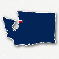
Everett, Washington
![]() Click on the key symbol in the main map to zoom into specific trails.
Click on the key symbol in the main map to zoom into specific trails.
BIKE PATHS / WALKING PATHS
Interurban Trail - Seattle to Everett
Langus Riverfront Nature Trail
Lowell Riverfront Trail
Marine View Drive Trail
North Creek Trail
Port of Everett Waterfront Trail
RELATED LINKS
Everett, Washington is located on Puget Sound, 27 miles north of Downtown Seattle. Snohomish is located about 8 miles inland. They are both located in Snohomish County. Everett is known for being a port city with the largest public marina on the west coast. It is also home to Boeing's largest assembly plant and the U.S. Naval Station Everett. Snohomish is a small inland city of historical significance and agricultural roots. This region of Washington is heavily forested but has many lakes and beautiful views of Possession Sound, part of Puget Sound, and the hills of Mt. Baker - Snoqualmie National Forest.
The two major recreational trail systems in the area are the Interurban Trail that comes up from the center of Seattle to the middle of Everett and the 29-mile long Centennial Trail that starts in Snohomish and heads north through Lake Stevens, the City of Arlington, and beyond.
Interurban Trail - Seattle to Everett
The Interurban Trail system extends over 20 miles from the north side of Seattle to the middle of the City of Everett. It is a paved trail system that has some sections of trail that are separated from the roadway and other sections that are bike lanes along the roadways. There are also marked bike lanes that will take you all the way to Downtown Seattle. Along the route, the trail passes through the communities of Seattle, Shoreline, Lynwood, Martha Lake and Everett. It roughly follows the route of Interstate 5.
Read more about the Interurban Trail - Seattle to Everett
The Centennial Trail in Snohomish County
The Centennial Trail is a 29-mile long paved and unpaved trail that follows the abandoned railroad beds of the Northern Pacific Railroad and Seattle, Lakeshore and Eastern Railroad. The trail is wide and has few turns and very gentle grades. The Centennial Trail goes through beautiful agricultural areas and dense forests of Snohomish County. The path roughly follows the same route as Highway 9. The trail is open for bike riding, walking, running and horseback riding.
The Centennial Trail in Snohomish County is located in the northwestern portion of the State of Washington. The path extends from a point on Highway 9 that is 8 miles north of the community of Arlington to the community of Snohomish, 8 miles southeast of Everett.
Read more about the Centennial Trail in Snohomish County
Langus Riverfront Nature Trail - Everett
The 3-mile long paved trail at Langus Riverfront Park is open for walking and cycling. It is an excellent place for bird watching, with all of the waterfowl and raptors. The trail takes you from Langus Riverfront Park along the Snohomish River and over to Spencer Island. There is an unpaved trail on Spencer Island you can use to explore the island. You can come back to Langus Riverfront Park on 4st Street SE if you want to make a loop.
The parking area for Langus Riverfront Park is on Smith Island Road off of Interstate 5.
Marine View Drive Trail - Everett
There is a 6-mile long paved bicycle path along E Marine View Drive that loops around the tip of the Everett Peninsula that gives you nice views of the Snohomish River and Jetty Island and eventually takes you over the Port of Everett Waterfront area. On the east end, this bike path starts at the end of Everett Avenue at Grand Avenue. It follows Grand Avenue going north from this intersection. After traveling under Interstate 5, Grand Avenue turns into E Marine View Drive. At this point, the trail goes right by Riverdale Park. There are a parking lot and other facilities at this park and it is a good place to start the trip along the trail. The trail follows alongside Marine View Drive on the east side of the peninsula which becomes the west side of the road on the other side of the loop adjacent to Port Gardner.
At the tip of the peninsula, you may choose head south on Alverson Boulevard, then east on 2nd Street to reach the Legion Memorial Park and the Evergreen Arboretum & Gardens. There are a parking lot and other facilities at this location.
As you continue on the Marine View Drive Trail on the west side of the peninsula, you can access the walking paths for the Port of Everett Waterfront from 10th street to 18th Street and W. Marine View Drive. At the end of the Marine View Drive Trail hooks up with the Port of Everett Access Trail along Terminal Avenue for reaching Pigeon Creek Beach. Take caution around the railroad tracks in this area.
Resources
Following are links to official off-site resources to find out more details about the recreational trails in Everett, Washington.

Tweet