

Map of bike paths / walking paths in the Vancouver, Washington area
Recreational trails for walking, running and cycling around Vancouver, Washington
Vancouver, Washington
![]() Click on the key symbol in the main map to zoom into specific trails.
Click on the key symbol in the main map to zoom into specific trails.
BIKE PATHS / WALKING PATHS
505 Multi-Use Path
Burnt Bridge Creek Trail
Captain Williams Park Trail
Columbia River Waterfront Renaissance Trail
Frenchmans Bar Trail
Gibbons Creek Wildlife Art Trail
I-205 Multi Use Path
Lacamas Lake Trail
Lacamas Park Trail
Padden Parkway Trail
Vancouver Lake Trail
Washington State University Campus Trail
RELATED LINKS
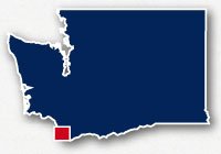
Vancouver is located along the Columbia River in the southwest corner of the State of Washington. The communities of Vancouver, Camas and Washougal are on the opposite side of the Columbia River from the Portland, Oregon metropolitan area. the other communities mentioned are located directly north of Vancouver. They are all located In Clark County.
The Clark County area in Southern Washington has several recreational trail systems for a variety of experiences. The Columbia River Waterfront Renaissance Trail will take you along the waterfront with beautiful views of the river, the bridges, looking over to the Portland, Oregon area and Mt. Hood. From this trail, you can also head south on the Interstate 5 bridge to get over to Hyden Island and Portland. Captain Williams Park Trail is also along the river, but in a more natural setting for observing the waterfowl and other wildlife in the local environment along the river. The Lacamas Lake Trail leads you through the forest along the lake. The Padden Parkway Trail follows the roadway and is good for commuting or for getting across that part of town easily. The Burnt Bridge River Trail wanders along through greenbelts and parks in the middle of the urban area. You can head up to Vancouver Lake Trail on the northwest side of town with pretty views of the water and of Mt. Hood in the distance and then travel over to Frenchman's Bar Trail for a walk along the river's edge.
Columbia River Waterfront Renaissance Trail & Discovery Historic Loop
The Columbia River Waterfront Renaissance Trail is a 5 mile long paved path that takes you along the waterfront of the Columbia River near Downtown Vancouver. It is a great place for walking, running or riding a bike. As you travel along the waterfront, there are lovely views of Mt. Hood and views of the two bridges heading down to Portland over the wide Columbia River. This is a wonderful place to stroll after diner or on a nice weekend. Bring your out-of-town guests so they can experience the best of Vancouver.
The west end of the trail system starts at Ester Short Park on 6th and Columbia in Downtown Vancouver. There are walking paths next to Columbia Street that lead you down to the waterfront. The trail goes under the Interstate 5 bridge, but there is an access path to the pedestrian walkway along the bridge if you want to walk over the Columbia River. If you continue on the main trail you will go by Joe's Crab Shack as the trail follows SE Columbia Way. In this stretch there are two other branches of the trail that come in from E. 5th Street near Pearson Field Airport. Another branch of the trail takes you down to the waters edge by the restaurants on SE Columbia River Drive.
The main branch of the Columbia River Waterfront Renaissance Trail continues along SE Columbia Way away from the water's edge for about 2 miles. The last little stretch of trail, at the east end of the trail system, takes you along the water's edge and ends at Wintler Park. This little park has a nice little beach with pretty views and a parking lot.
Read more about the Columbia River Renaissace Trail
Frenchman's Bar & Vancouver Lake Trail
These two trail systems are located northwest of the Vancouver area. They are just south of the Shillapoo Wildlife Recreation Area, Vancouver Lake is to the east and the Columbia River flows north on the west.
Frenchman's Bar Regional Park is a 120-acre area with reservable picnic shelters and volleyball courts, playgrounds, restrooms and parking. The trails that run through this park are paved and non-paved trails that wander past the playing fields, agricultural fields and parking areas down to the beach and Hewlett Point along the river. There is also a 2.5 mile long paved trail along the road to head over to Vancouver Lake.
Vancouver Lake Regional Park is a 190-acre park located on the western shore of Vancouver Lake. This is a lovely place for a picnic or a stroll along the shore with pretty views across the lake and Mt. Hood, Mt. Adams and Mt St. Helens in the distance. It's a fantastic location for observing the local waterfowl and other wildlife. The trails wander along the water's edge. Head north from the parking area and this trail will take you through the forested area along the shore, then head west up to NW Erwin O Reiger Memorial Highway. Head south from the parking area on the 2.5 mile long paved trail to ride over to Frenchman's Bar Regional Park.
Captain William Clark Trail & Gibbons Creek Wildlife Art Trail
The Captain William Clark Regional Park is at Cottonwood Beach which is the location where the Lewis and Clark Expedition established a camp before heading back up the Columbia River Gorge. The park is located south of Highway 14 and 16 miles from Downtown Vancouver. The park has picnic shelters and tables, restrooms and paved and unpaved trails. In this location as well is the Steigerwald Lake National Wildlife Refuge which is on the southwestern end of the Columbia River Gorge National Scenic Area.
The main unpaved trail through the area is about 3.5-miles long. It starts on the west end at the trailhead at 15th Street and Highway 14 (Lewis and Clark Highway). At this western trailhead there is parking and a pier that you can walk out to see the river a little closer. The trail then goes through Captain William Clark Park and parallels Index Street. there is parking along Index Street and a restrooom. There is another trail that you can take around the park to see the interpretive canoes and to reach the picnic shelters.
The main unpaved trail keeps heading east along the edge of the woods towards the Steigerwald National Wildlife Refuge. The Gibbons Creek Wildlife Art Trail comes in at two locations along this stretch. These trails converge and head north to a trailhead with parking on Highway 14. The northeastern trail is closed for part of the season for protection of the nesting waterfowl. Along the trail is the Columbia Gorge Overlook, the Steigerwald Lake Overlook, the Redtail Lake Overlook and a fish ladder as well as interpretive art along the trail.
The main unpaved trail continues along the river for another half a mile.
Salmon Creek Greenway and Trail
Salmon Creek Regional Park is located north of the Vancouver, Washington, area to the west of Interstate 5. The park has 35 areas of developed space with water playgrounds, swimming areas, athletic fields, playgrounds, restrooms and parking. The park also has 368 acres of natural greenspace known as the Salmon Creek Greenway. There is a 3-mile long multi-use paved trail through a portion of the greenway plus other unpaved trails for experiencing the area.
The park is located on NE 117th Street, just west of Interstate 15. The trails take off in many directions from the developed portion of the park. You can stroll along Klineline Pond, follow the trail under the interstate to see East Pond, or head west through the woods along the river all the way up to the trailhead with parking at NW 36th Avenue. The main trail system extends over 3 miles and there are access trails into the adjacent residential neighborhoods including Cougar Creek Trail.
Read more about the Salmon Creek Trail
Burnt Bridge Creek Trail
The Burnt Bridge Creek Trail is an 8-mile long paved pathway that extends from Vancouver Lake on the west side of the city to NE Burton Road at the north end of Meadow Brush Park. The trail is open for walking, running and bikes. Most of the trail is fairly level with some steeper areas near the west end at the Bernie Drive Trailhead and again in a few spots around where the trail crosses Interstate 5.
The west end of the trail is located at a trailhead with parking at NW Lakeshore Drive and NW Bernie Drive. From here the trail heads upstream through the woods above the floodplain. At around 1.5 miles, the trail reaches NE Hazel Dell Avenue. It follows the street for a short distance then the trail heads to the east down to follow the off-ramp for the interstate and heads under Main Street. From here is goes across Interstate 5 on a pedestrian bridge. Just east of the overpass, an access trail heads to the north along Main Street. The main trail takes a loop and heads south to go through Leverich Park. In this same section, another branch of the trail heads north to the Park & Ride on NE Ross Street and NE 115th Avenue.
After going through Leverich Park the trail follows NE 41st Circle for a short ways then heads into Arnold Park and crosses NE St. James Road at street level. After this the trail heads under Highway 500, goes through a thickly forested section then out to the open through open grassy areas for rest of the route. A couple of side trails will take you up towards NE 18th Street and NE Andersen Avenue. The Burnt Bridge Creek Trail ends on the west at the north edge of Meadowbrook March Park at NE Burton Road.
Read more about the Burnt Bridge Creek Trail
Padden Parkway Trail
The Padden Parkway Trail is a 5.25 mile long paved path that runs separate but adjacent to Padden Parkway from NE 78th Street to NE Ward Road. It goes by Heritage High School and numerous businesses along the way. It has its own separate bridge for crossing the Interstate 205 and NE Padden Parkway interchange.
Washougal River Greenway Trail
The Washougal River Greenway Trail is located on the east side of the city between Highway 14 and NE 3rd Avenue. The paved trail starts on NE 3rd Loop near NE Summer Street. The 1-mile long paved trail trail crosses the Washougal River with a long bridge and wanders by a couple of small lakes. The east end is on SE Yale Street. From here there is a pathway to go down to Goot Park.
Lacamas Heritage Trail & Lacamas Park Trail
Lacamas Lake Regional Park is located in the City of Camas, east of Vancouver. It is a beautiful 311-acre forested park with Lacamas Creek running through the middle. The park is located southeast of Lacamas Lake and east of Everett Street. There are miles of unpaved trails for exploring the woods, viewing the waterfall, crossing over the creek on a trestle bridge and observing the birds, wildflowers, foliage and wildlife.
Lacamas Heritage Trail extends from the parking area for Lacamas Lake Regional Park at NE Lake Road and NE Everett and heads to the northeast through the woods on the western side of the Lake Lacamas. It is an unpaved, but well groomed, trail that extends over 3 miles all the way up to the trailhead at NE Goodwin Road and NW Underwood Street
Resources
Following are links to official off-site resources to find out more details about the recreational trails in Vancouver, Washington.
Vancouver: Parks & Recreation Trail Map
Clark County: Vancouver Lake Regional Park
Clark County: Frenchman's Bar Regional Park
Clark County: Map of Frenchman's Bar and Vancouver Lake Trails
Clark County: Lacamas Heritage Trail Map
Clark County: Lacamas Park Trail
Clark County: Salmon Creek Greenway Trail Map
U.S. Fish and Wildlife Service: Gibbons Creek Wildlife Art Trail

Tweet