

Map of regional recreational trails in Colorado
Regional Recreational trails for walking, running and cycling in Colorado
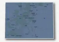
Regional Recreational Trails in Colorado
![]() Click on the key symbol in the main map to zoom into specific trails.
Click on the key symbol in the main map to zoom into specific trails.
Colorado has a vast network of regional recreational trails for bike riding, walking and running located throughout the state. These trails are for non-motorized public use and connect communities, schools, parks, neighborhoods, natural areas, commercial areas and tourist destinations. These trails are located in cities along the front range, in small towns in the mountains or out in the open spaces. They provide an excellent place to see the beautiful vistas of Colorado away from traffic and congestion or provide a way to safely commute by bike to work or to school.
The Front Range cities are located along Interstate 25 to the east of the Rocky Mountains. These cities have the majority of the population within the state and each has an expansive networks of interconnecting bike paths / pedestrian paths. There are recreational trails located within many of the rural towns in the mountains as well as along the Western Slope cities of Fruita, Grand Junction and Montrose.
Below is a list of regional recreational trails located throughout the State of Colorado. Trail names in red are links to maps and descriptions for that particular trail. Distances are approximate. Many additional trails are displayed with our maps for the various cities in Colorado.
| TRAIL NAME | LENGTH (MI.) |
SURFACE | COMMUNITIES |
|---|---|---|---|
| NORTHWEST | |||
| Yampa River Core Trail | 7.5 | paved | Steamboat |
| NORTH CENTRAL | |||
| Firestone Trail | 6 | paved / unpaved | Firestone, Frederick, Dacono |
| Fossil Creek Trail | 5.3 | paved | Fort Collins |
| Loveland Recreation Trail | 14 | paved | Loveland |
| Mason Trail | 4.7 | paved | Fort Collins |
| Poudre River Trail | 21 | paved | Windsor, Greeley |
| Poudre Trail | 10 | paved | Bellvue, Laporte, Fort Collins |
| Spring Creek Trail | 7 | paved | Fort Collins |
| BOULDER COUNTY | |||
| Boulder Creek Trail | 8.1 | paved | Boulder |
| Coal Creek Trail | 14 | unpaved / paved | Superior, Broomfield, Louisville, Lafayette, Erie |
| Longmont-to-Boulder Regional Trail (LoBo Trail) | 10 | unpaved / paved | Longmont, Niwot, Gunbarrel, Boulder |
| Rock Creek Trail | 8 | unpaved | Lafayette, Broomfield, Superior |
| DENVER METRO | |||
| Bear Creek Trail | 14.5 | paved | Sheridan, Denver, Lakewood, Morrison |
| Farmers' High Line Canal Trail | 13 | paved | Arvada, Westminster |
| C-470 Multi-Use Trail | 20 | paved | Golden, Morrison, Lakewood, Ken Caryl, Highlands Ranch |
| Centennial Trail | 13 | paved | Centennial |
| Cherry Creek Trail | 41 | paved | Denver, Centennial, Parker, Franktown |
| Cherry Creek Spillway Trail | 3.4 | paved | Aurora |
| Clear Creek Trail | 20 | paved | Commerce City, Denver, Arvada, Golden |
| Farmers' High Line Canal Trail | 10 | paved / unpaved | Westminster, Northglenn, Thornton |
| High Line Canal Trail | 60 | paved / unpaved | Aurora, Denver, Littleton, Highlands Ranch |
| Lee Lateral Ditch Trail | 4.5 | paved | Thornton |
| Little Dry Creek Trail | 7.2 | paved | Denver, Westminster |
| Mary Carter Greenway Trail | 8 | paved | Englewood, Littleton |
| Niver Creek Trail | 4 | paved / unpaved | Thornton |
| Piney Creek Trail | 10 | paved | Centennial, Aurora |
| Ralston Creek Trail | 12.6 | paved | Arvada |
| Sand Creek Trail | 15 | paved / unpaved | Commerce City, Denver, Aurora |
| Signal Ditch Trail | 2.4 | paved | Thornton |
| South Platte River Trail | 30 | paved | Denver |
| Toll Gate Creek Trail | 10 | paved | Aurora |
| U.S. 36 Bikeway | 15 | paved | Boulder, Superior, Broomfield, Westminster |
| CENTRAL | |||
| Arkansas Riverwalk | 5.5 | unpaved | Cañon City |
| East Plum Creek Trail | 5.6 | paved | Castle Rock |
| ERPD Recreation Trail | 5 | paved | Evergreen |
| Pikes Peak Greenway Trail | 15+ | paved / unpaved | Colorado Springs |
| Fountain Creek Regional Trail | 10 | unpaved | Colorado Springs, Security Widefield, Fountain |
| New Santa Fe Regional Trail | 16 | unpaved | Palmer Lake, Air Force Academy, Colorado Springs |
| Pueblo River Trail System | 14 | paved | Pueblo |
| MOUNTAINS - CENTRAL5 | |||
| Fraser River Trail | 5 | paved / unpaved | Winter Park, Fraser |
| Glenwood Canyon Recreation Path | 16.3 | paved | Glenwood Springs, Dotsero |
| Rio Grande Trail | 42 | paved / unpaved | Glenwood Springs, Carbondale, Basalt, Aspen |
| Mineral Belt Trail | 11.6 | paved | Leadville |
| Monarch Spur Trail | 2.46 | paved | Salida |
| Summit County - Snake River Recpath | 3 | paved | Keystone, Dillon |
| Summit County - Dillon Reservoir Recpath | 17 | paved | Dillon, Frisco |
| Summit County - Blue River Recpath | 7.5 | paved | Frisco, Breckenridge |
| Summit County - Tenmile Recpath | 9 | paved | Frisco, Copper Mountain |
| Summit County - Lower Blue River Recpath | 2 | paved | Frisco, Silverthorne |
| Vail Pass - Tenmile Canyon National Recreation Trail | 18 | paved | Vail, Copper Mountain |
| WEST | |||
| Colorado Riverfront Trail | 20 | paved | Fruita, Grand Junction, Clifton, Palisade |
| Uncompahgre River Trail | 8+4 | paved / unpaved | Montrose, Vernal, Dallas, Ridgway |
| SOUTHWEST | |||
| Animas River Trail & Greenway | 7.5 | paved | Durango |
| San Miguel River Path | 6.7 | paved / unpaved | Telluride |
Resources
Following are links to official off-site resources to find out more details about the recreational trails located in Colorado.

Tweet