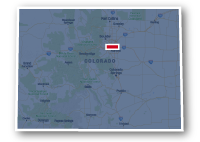
Map of the Bear Creek Trail
Bear Creek Trail

Bear Creek Trail
LENGTH:
14.5 miles
SURFACE:
paved
COMMUNITIES:
Morrison, Lakewood, Denver, Sheridan
HIGHLIGHTS:
Bear Creek Lake Regional Park, Fox Hollow Golf Course, Bear Creek Park, Rever Point at Sheridan shopping center
NEARBY TRAILS:
C-470 Bikeway
S. Kipling Parkway Multi-Use Path
South Platte River Trail
Mary Carter Greenway
RELATED LINKS:
The Bear Creek Trail is a 14.5-mile long paved pathway that spans between the communities of Morrison and Sheridan in Central Colorado. The trail follows alongside Bear Creek as it meanders through residential neighborhoods, golf courses and parks, past commercial areas, eventually intersecting the South Platte River Trail and the Mary Carter Greenway near W. Hampden Avenue and S. Santa Fe Drive.
Conditions
The Bear Creek Trail is paved for the entire route. The trail is open for non-motorized use such as bike riding, walking and running. The trail does climb in elevation from east to west. The easterly 7 miles is fairly flat, but there are some climbs in the western 7.5 miles.
Communities
The Bear Creek Trail goes past the following communities: Morrison, Lakewood, Denver and Sheridan.
Points of Interest
The Bear Creek Trail goes past the following points of interest:
| Denver Mountain Parks | Bear Valley Park |
| Downtown Morrison | John F. Kennedy High School |
| C-470 Bikeway | Bear Valley Shopping Center |
| Bear Creek Lake Regional Park | Bear Creek Park |
| Homestead Golf Course | Mullen High School |
| Fox Hollow Golf Course | Broken Tee Golf Course |
| Bear Creek High School | River Point at Sheridan Shopping Center |
| Bear Creek K-8 School | South Platte River Trail |
| The Stone House | Mary Carter Greenway |
Nearby Trails
The Bear Creek Trail intersects multiple other recreational trails along its route. There are trails within Bear Creek Lake Regional Park and other local parks along the way as well as regional recreational trails.
C-470 Bikeway: the two trails coincide within Bear Creek Lake Regional Park.
S. Kipling Parkway Multi-Use Trail: these trails intersect at 0.65 mile north of Highway 285.
South Platte River Trail and Mary Carter Greenway: the three trails intersect along S. Platte River Drive in the River Point at Sheridan shopping area on W. Hampden Avenue and S. Santa Fe Drive.
End Points
The west end of the Bear Creek Trail is located to the southwest of the intersection of Highway 8 and Bear Creek Avenue in Morrison.
The east end of the Bear Creek Trail is located at River Point at Sheridan Shopping Center near W. Hampden Avenue and S. Santa Fe Drive in Sheridan.
Resources
Following are links to official off-site resources to find out more details about the Bear Creek Trail, Colorado.


Tweet