

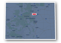
Map of the Cherry Creek Trail
Cherry Creek Trail
Cherry Creek Trail
LENGTH:
42 miles
SURFACE:
paved
COMMUNITIES:
Denver, Glendale, Aurora, Greenwood Village, Cottonwood, Parker, The Pinery, Franktown
HIGHLIGHTS:
Confluence Park, Auraria Campus, Downtown Denver, Cherry Creek State Park, local parks
NEARBY TRAILS:
South Platte River Trail
High Line Canal Trail
Cottonwood Creek Trail
Centennial Trail
Parker Recreational Trail
Sulphur Gulch Trail
Pinery Loop Trail
RELATED LINKS:
The Cherry Creek Trail is a 42-mile long paved pathway that travels from Downtown Denver, past Cherry Creek Reservoir, through Parker and ends at Franktown to the east of Castle Rock. The trail is located in the natural greenbelt alongside Cherry Creek as it meanders through the heart of the urban downtown area, goes through historic neighborhoods in the middle of Denver, goes past the suburban residential and commercial areas and eventually winds through high prairie grasslands and cottonwood groves.
The Cherry Creek Trail is a popular trail and is used by those commuting to work or to school, tourists taking in the sights and the locals getting some outdoor exercise. The trail connects to numerous other recreational trails along the way and is a portion of the Colorado Front Range Trail.
In the Downtown Denver area the trail starts at the confluence of Cherry Creek and the South Platte River at Confluence Park where it intersects the South Platte River Trail. The trail then follows the channel for the creek that forms a protective corridor as it goes past the busy downtown streets. Union Station, LoDo, the Auraria campus, Larimer Square, the Colorado Convention Center, the state capital building and numerous other attractions are located in this area. The trail then heads southeast going past the Denver Country Club and Cherry Creek Shopping Center. The trail then goes past Kennedy Golf Course and then climbs to tuck under Interstate 225 and then another climb over the dam for Cherry Creek Reservoir.
At the Cherry Creek State Park, there is a choice to go around the reservoir to the north or to the south. The trails meet up again at the south end of the reservoir. Farther south, the trail goes under E-470 and heads into the community of Parker. South of Parker the trail goes through more natural areas and ends to the southwest of the small community of Franktown.
Conditions
The Cherry Creek Trail is paved for the entire route. The portion in the Downtown Denver area can become congested. There is a section in the channelized area where the trail splits into two one way paths. Farther to the south, the trail is less congested. There are a couple of climbs to either side of Interstate 225, one of the steeper sections is next to the John F. Kennedy Golf Course, the other climb is getting over the dam for Cherry Creek Reservoir.
Communities
The Cherry Creek Trail goes past the following communities: Denver, Glendale, Aurora, Greenwood Village, Cottonwood, Parker, The Pinery and Franktown.
Points of Interest
The Cherry Creek Trail goes past the following points of interest:
| Confluence Park | John F. Kennedy Golf Course |
| South Platte River Trail | John F. Kennedy Park |
| Downtown Children's Playground | Cherry Creek Reservoir Dam |
| Pepsi Center | Cherry Creek State Park |
| Auraria Campus | Cottonwood Creek Trail |
| University of Colorado Denver | Village Greens Park |
| Colorado Convention Center | Valley Country Club |
| Sunken Gardens Park | Cherry Creek Soccer Complex |
| West High School | Cherry Creek Valley Ecological Park |
| Hungarian Freedom Park | Parker Jordan Centennial Open Space |
| Denver Country Club | Red Hawk Ridge Elementary School |
| Cherry Creek Shopping Center | 17 Mile House Farm Park |
| Cherry Creek Park | Cottonwood Park East / West |
| City of Brest Park | Centennial Trail |
| Creekside Park | Challenger Regional Park |
| Four Mile Historic Park | Parker Recreation Center |
| McMeen Elementary School | Recreational Trail |
| Garland Park | Railbender Park |
| Place Bridge Academy | Bar CCC Park |
| Cook Park Recreation Center | Sulphur Gulch Trail |
| City of Chenai Park | Salisbury Equestrian Park |
| Cherry Creek County Club | Stroh Ranch Soccer Fields |
| Highline Canal Trail | Pinery Loop Trail |
| Hentzel Park | Ponderosa High School |
| Joe Shoemaker School | Hidden Mesa Open Space |
Nearby Trails
The Cherry Creek Trail intersects several other regional recreational trails as well as trails within the many parks and neighborhoods along the route.
South Platte River Trail: at Confluence Park, Downtown Denver at 15th Street and Little Raven Street
High Line Canal Trail: south end of Cherry Creek Country Club, northwest end of Hentzel Park, north of E. Cornell Avenue and west of S. Havana Street in Denver.
Cottonwood Creek Trail: on the south side of Cherry Creek Reservoir in Cherry Creek State Park.
Piney Creek Trail: at the south end of Cherry Creek State Park, north of E. Caley Avenue and west of S. Parker Road.
Happy Canyon Trail: at Cherry Creek Valley Ecological Park, north of Happy Canyon Parkway in Centennial.
Centennial Trail: on the south side of the underpass for E-470 and west of the Parker Road interchange in Parker.
Parker Recreational Trail: just north of Challenger Regional Park on Lincoln Avenue in Parker,
Sulphur Gulch Trail: at Bar CCC Park near Mainstreet and S. Twentymile Road in Parker.
Pinery Loop Trail: west of N. Pinery Parkway and Highway 83.
End Points
The north end of the Cherry Creek Trail is located at Confluence Park near 15th Street and Little Raven Street in Downtown Denver.
The south end of the Cherry Creek Trail is located south of Highway 86 near Franktown.
Resources
Following are links to official off-site resources to find out more details about the Cherry Creek Trail in Central Colorado.

Tweet