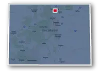
Map of the Mason Trail in Fort Collins
Mason Trail

Mason Trail
LENGTH:
4.7 miles
SURFACE:
paved
COMMUNITIES:
Ft. Collins
HIGHLIGHTS:
Downtown Fort Collins, CSU campus, Fort Collins South Transit Station, residential neighborhoods
NEARBY TRAILS:
Spring Creek Trail
Fossil Creek Trail
RELATED LINKS:
The Mason Trail is a 4.7-mile long paved pathway that spans between the Colorado State University Campus to the south end of Fort Collins in North Central Colorado. The route of the trail lies between the College Avenue corridor of commercial shopping malls and restaurants and the residential neighborhoods on the southwest side of the city. A portion of the trail also follows alongside the New Mercer Canal.
The Mason Trail provides a way for cyclists to commute to CSU or Downtown Fort Collins.The trail is a compliment to the Fort Collins MAX Bus Rapid Transit system and the southern end of the trail is near the South Transit Station.
The trail also provides a way to connect to other recreational trails in the Fort Collins area, particularily the Spring Creek Trail and the Fossil Creek Trail.
Conditions
The Mason Trail is paved for the entire route. The trail is open for bike riding, walking and running. There are numerous street crossings along the route and some areas are quite congested. There are access paths for crossing the railroad near the Whole Foods, at Johnson Drive and W. Troutman Parkway. There are also access paths that cross the ditch to reach the residential neighborhoods.
Communities
The Mason Trail goes through the following communities: Fort Collins.
Points of Interest
The Mason Trail goes past the following points of interest:
| Colorado State University campus |
| Creekside Park |
| New Mercer Canal |
| South Transit Center |
Nearby Trails
Spring Creek Trail: the two trails conjoin for a short stretch to the south of W. Prospect Road and west of the railroad tracts. The Spring Creek Trail runs in both an east and west direction from this location.
Fossil Creek Trail: the south end of the Mason Trail meets the west end of the eastern section of the Fossil Creek Trail. The Fossil Creek Trail then tucks under College Avenue and heads southeast as far as Fossil Creek Park on S. Lemay Avenue
End Points
The north end of the Mason Trail is located along W. Laurel Street to the west of S. College Avenue on the north side of the CSU campus.
The south end of the trail is located to the west of S. College Avenue and south of Cameron Drive on the south end of Fort Collins.
Resources
Following are links to official off-site resources to find out more details about the Mason Trail in Fort Collins, Colorado


Tweet