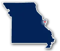
Map of Forest Park
Forest Park Bike Path

Forest Park Bike Path
LENGTH:
5.5 miles
SURFACE:
paved
COMMUNITIES:
St. Louis
HIGHLIGHTS:
Zoo, museums, gardens, athletic fields, picnic areas
RELATED LINKS:
Forest Park is a very large park to the west of Downtown St. Louis. It has numerous walking paths and other attractions. Forest Park is located just to the north of Interstate 64 and is situated between S. Skinner Boulevard and S. Kingshighway Boulevard.
The park serves as a centerpeice for St. Louis and is a great place to bring out of town visitors. There are musuems, athletic fields, gardens, playgrounds, a fish hatchery and multiple other attractions.
In addition to the network of walking paths that are located within the park, there is a 5.5-mile long paved path for bikes only that wraps around the perimeter of the entire park.
Points of Interest
Forest Park in St. Louis is the location of the following attractions:
| Saint Louis Zoo |
| Saint Louis Art Museum |
| Dwight Davis Tennis Center |
| Art Hill |
| The Muny |
| Worlds Fair Museum |
| Boeing Aviation Athletic Fields |
| James S. McDonnel Planetarium |
| Wildlife Island |
| Richard Hudlin Tennis Courts |
| Kennedy Forest |
| The Highlands Golf and Tennis Center; |
| Misourri History Museumm |
| Dennis & Judith Jones Visitor & Education Center |
| Norman K. Probstein Golf Course and Youth Learning Center |
Resources
Following are links to official off-site resources to find out more details about Forest Park in St. Louis, Missouri.


Tweet