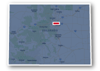
Map of the Dillon Reservoir Recpath
Dillon Reservoir Recpath

Dillon Reservoir Recpath
LENGTH:
17 miles
SURFACE:
paved
COMMUNITIES:
Dillon, Frisco
HIGHLIGHTS:
Lake Dillon, Dillon Dam, views of the Tenmile Range, Grays and Torreys and other peaks.
NEARBY TRAILS:
Blue River Recpath
Tenmile Recpath
Lower Blue River Recpath
Snake River Recpath
RELATED LINKS:
The Dillon Reservoir Recpath is a 17-mile long paved pathway that goes most of the way around Dillon Reservoir in Summit County. The recpath travels along the shores of Lake Dillon, through aspen groves and evergreens. The trail goes across the face of Dillon Dam and there are beautiful views of the surrounding mountains and the boats out sailing on the water. The trail goes past the communities of Dillon and Frisco and connects to several other recreational trails in the area.
The peaks that can be seen from the Dillon Reservoir include the two fourteen thousand foot high peaks of Grays and Torreys to the east, the peaks of the Tenmile Range above Frisco, Mt. Guyot and Whale Peak to the south and Buffalo Mountain in the Gore Range to the north of Interstate 70.
Conditions
The Dillon Reservoir Recpath is paved for the entire route. The trail is open for bike riding, walking and running. Most of the trail is a separate path, but there are some sections adjacent to roadways. There are hilly stretches of the trail and the elevation is above 9000 feet. Visitors to Colorado should take care to avoid altitude related illnesses.
Most of the trail is a separate pathway with few road crossings. The paved trail is continuous except for a stretch along Swan Mountain Road. This 1.7-mile long stretch of roadway is steep and can have heavy traffic.
Communities
The Dillon Reservoir Recpath goes past the following communities: Dillon and Frisco.
Points of Interest
The Dillon Reservoir Recpath goes past the following points of interest:
| Summit High School |
| Blue River Recpath |
| Tenmile Recpath |
| St. Anthony Medical Center |
| Frisco Adventure Park |
| Frisco Bay Marina |
| Summit Middle School |
| Giberson Bay Day Use Fishing Site |
| Dillon Dam |
| Marina Park |
| Dillon Marina |
| Snake River Recpath |
| Summit Cove |
| Sapphire Point Overlook |
Nearby Trails
Dillon Reservoir Recpath connects to several other recreational trails along its route.
Snake River Recpath: the trails intersect just west of Swan Mountain Road to the east of the Town of Dillon. The Snake River Recpath heads up to the base of the Keystone Ski Area.
Blue River Recpath: the two trails meet near Summit High School on the south end of Lake Dillon to the west of Highway 9. The Blue River Recpath heads south to the Town of Breckenridge.
Tenmile Recpath: the two trails meet near St. Anthony Medical Center to the south of Highway 9 on the south end of Lake Dillon. The Tenmile Recpath heads to the south west and wraps around Frisco before heading up to the ski area of Copper Mountain.
Upper Blue River Recpath: this trail starts at the base of Dillon Dam, and heads north tucking under Interstate 70 to go through the Town of Silverthorne along the banks of the Blue River.
Resources
Following are links to official off-site resources to find out more details about the Dillon Reservoir Recpath, Colorado.


Tweet