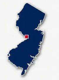
Map of bike paths / walking paths in the Trenton area
Recreational trails for walking, running and cycling in Trenton, New Jersey
Trenton is located along the Delaware River in Mercer County in Central New Jersey. Trenton is 28 miles northeast of Philadelphia.
D & R Canal Trail
The Delaware and Raritan Canal State Park is located in Central New Jersey and passes through Trenton. The 70-mile long D & R Canal Trail runs through the park alongside the canal and near to the Delaware River then the Raritan River. The state park is open for canoeing along the canal and riding a bike or hiking along the trail. The trail goes through beautiful forests rich with wildlife or across wetlands.Along the trail you will find historic bridges, stone arched culverts, historical homes and canoes and kayaks along the canal.The D & R Canal Trail follows the old towpath for the canal where mules would pull the boats along.
From Downtown Trenton, the D & R Canal Trail heads to the northwest along the canal and to the northeast running alongside canal and Highway 1.
Read more about the D&R Canal Trail
Mercer County Park
Mercer County Park includes 2,500 acres located within the Townships of West Windsor, Hamilton and Lawrence. The park has year-round facilities which includes athletic fields, Mercer Lake, the Mercer County Tennis Center, the Mercer County Park Fairgrounds, and over 4 miles of paved pathways.
Union Transportation Trail
The Union Transportation Trail is a 8.8-mile long paved and unpaved pathway that spans between and Hornerstown and Robbinsville in eastern Monmouth County. The trail follows the route of an abandoned railroad right-of-way and goes through the rural countryside. The trail crosses several creek, goes through woodlands and past farms.
The north end of the Union Transportation Trail is located along Hervert Road near Sharon Station Road. The south end is located along Millstream Road to the west of Monmouth Road.
Resources
Following are links to official off-site resources to find out more details about the recreational trails located in Trenton, New Jersey.


Tweet