

Map of bike paths / walking paths in the Blaine area
Recreational trails for walking, running and cycling in Blaine, Minnesota
Blaine, Minnesota
![]() Click on the key symbol in the main map to zoom into specific trails.
Click on the key symbol in the main map to zoom into specific trails.
BIKE PATHS / WALKING PATHS
125th Avenue Trail
85th Avenue Trail
Bunker Hills Regional Park Trail
Lexington Avenue Trail
Pioneer Park Trail
Radisson Road Trail
Rice Creek North Regional Trail
South Lake Boulevard Trail
Tree's Edge Park Trail
RELATED LINKS
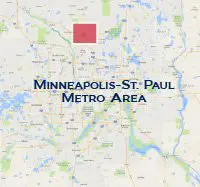
Blaine is located 12 miles to the north of Downtown Minneapolis.
Blaine has a network of recreation trails that follow alongside major roadways or wander through residential neighborhoods and natural areas.
Resources
Following are links to official off-site resources to find out more details about the recreational trails in Blaine, Minnesota.

Tweet