

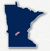
Map of the Glacial Lakes State Trail
Glacial Lakes State Trail
Glacial Lakes State Trail
LENGTH:
21.7 miles + 8.2 miles
SURFACE:
paved
COMMUNITIES:
Willmar, Spicer, New London, Hewick, Paynesville, Roscoe, Richmond and Cold Spring
HIGHLIGHTS:
rail trail, farmland, natural areas, rural communities
NEARBY TRAILS:
Paynesville Trail
Lake Koronis Recreational Trail
Rocori Trail
RELATED LINKS:
The Glacial Lakes State Trail consists of two separated paved pathways that span between Willmar and Cold Spring in Central Minnesota. The trail follows the route of an abandoned railroad right-of-way and travels through a rural area of the state. The route includes miles of farmland, wooded areas, several lakes and rural communities.
The southern portion of the Glacial Lakes State Trail is 21.7 miles long and spans between Willmar and Paynesville. In Willmar, trail users can use local recreational trails to reach Robbins Island Park. In Paynesville, trail users can connect to local trails to wrap around most of Lake Koronis.
The northern portion of the Glacial Lakes State Trail is 8.2-miles long and spans between the ommunities of Roscoe and Cold Spring. The northeastern end of the trail is located about 17 miles from Downtown St. Cloud.
Conditions
The Glacial Lake State Trail is paved for the entire route. The trail travels away from roads and traffic and has relatively few road crossings. The trail is open for bike riding, running and walking.
Communities
The Glacial Lake State Trail goes past the following communities: Willmar, Spicer, New London, Hewick, Paynesville, Roscoe, Richmond and Cold Spring.
Points of Interest
The Glacial Lake State Trail goes past the following points of interest:
| Willmar Civic Center |
| Willmar High Senior School |
| Elkhorn Lake |
| Green Lake Baseball Diamonds |
| causeway across Neat Lake |
| New London Spicer High School |
| Downtown Cold Spring |
Nearby Trails
Paynesville Trail & Lake Koronis Recreational Trail: The Glacial Lake State Trail meets the Paynesville Trail in Paynesville. The Paynesville Trail then least to the Lake Koronis Recreational Trail that wraps around Lake Koronis.
Rocori Trail: the two trails meet at 178th Avenue in Cold Spring. The Rocori Trail continues along the same abandoned railroad right of way for 3 more miles to Sauk River Road
End Points
The Glacial Lake State Trail has two separate sections with a 9-mile long gap in between.
The southwest end of the 21.7-mile long southwestern section is located along Civic Center Drive to the west of County Road 9 NE in Willmar. The northeast end of this section is located along Roseville Road NE to the north of 262nd Avenue in Paynesville.
The southeast end of the 8.2-mile long northeastern section is located along Main Street in the town of Roscoe. The northeast end of this section is located along Route 23 at 178th Avenue in Cold Spring where it meets up with the Rocori Trail.
Resources
Following are links to official off-site resources to find out more details about the Glacial Lakes State Trail in Minnesota.

Tweet