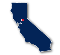
Map of the Folsom South Canal Trail
Folsom South Canal Trail

Folsom South Canal Trail
LENGTH:
15.5 miles
SURFACE:
paved
COMMUNITIES:
Nimbus, Gold River, Rancho Cordova, Elk Grove
HIGHLIGHTS:
Nimbus Dam Recreation Area, the canal, Mather Lake, Mather Regional Park, farmland
NEARBY TRAILS:
American River Parkway - Jedediah Smith Memorial Trail
RELATED LINKS:
The Folsom South Canal Trail is a 15.5-mile long paved trail that travels alongside the Folsom South Canal. The Folsom South Canal is located south and east of the Sacramento Metro Area. The trail extends from the Nimbus Dam at Lake Nathrop at Hazel Avenue and Highway 50 then heads south to the community of Wilton. The canal goes through wide open agricultural areas away from traffic. This is a good trail to take for a fairly straight, level and uninterrupted bike ride as there are long stretches between street intersections.
The trail has a tunnel for crossing Highway 50 and an underpass at International Drive. Just south of International Drive you can connect with trails in the Villages of Zinfandel neighborhood and Stone Creek Community Trails. After going under Douglas Road the trail goes by Mather Lake and Mather Regional Park. There is parking available at Jackson Road, where the trail crosses at street level.
Conditions
The Folsum South Canal Trail is paved for the entire route. The trail is open for bike riding, walking and running. The route has relatively few street crossings.
Communities
The Folsum South Canal Trail goes past the following communities: Nimbus, Gold River, Rancho Cordova and Elk Grove.
Points of Interest
The Folsum South Canal Trail goes past the following points of interest:
| Nimbus Dam Recreation Area |
| Mather Regional Park |
Nearby Trails
The Folsum South Canal Trail allows connections to several other recreational trails in the area.
American River Parkway - Jedediah Smith Memorial Trail: The two trails meet at the north end of the Folsom South Canal Trail at Hazel Drive and Highway 21 at the Nimbus Dam Recreation area.
End Points
The north end Folsom Canal Trail starts at Nimbus Dam near the Hazel Avenue Bridge. This is also near the junction with the American River Parkway - Jedediah Smith Memorial Trail and the East Nathrop Lake Trail. The trailhead is near the Sacramento State Aquatic Center. There are also other access trails for getting over to the Folsom South Canal Trail.
The south end of the Folsom South Canal Road is at the Consumnes River about 1.5 miles southeast from Sloughhouse Road.
Resources
Following are links to official off-site resources to find out more details about the Folsom South Canal Trail in Central California.


Tweet